How to sell products in a world where most people protect themselves against excessive information? Hologram table is the answer.
Have you ever heard of clip thinking? It is a wonderful ability of our brain to catch the most important, bright, and valuable information from the boundless ocean of data surrounding us. Fortunately, most modern people have exactly this type of thinking. We are good at memorizing new and unusual patterns, while monotonous information is not retained for long.
How to prove that your offer is something that deserves to be retained in other people’s memory? The solution does exist. I’m telling you about virtual and augmented reality— innovative technologies, which involve customers in the demonstration process and make them active participants.
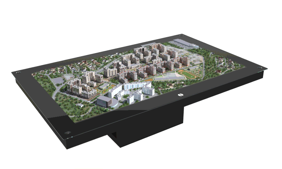
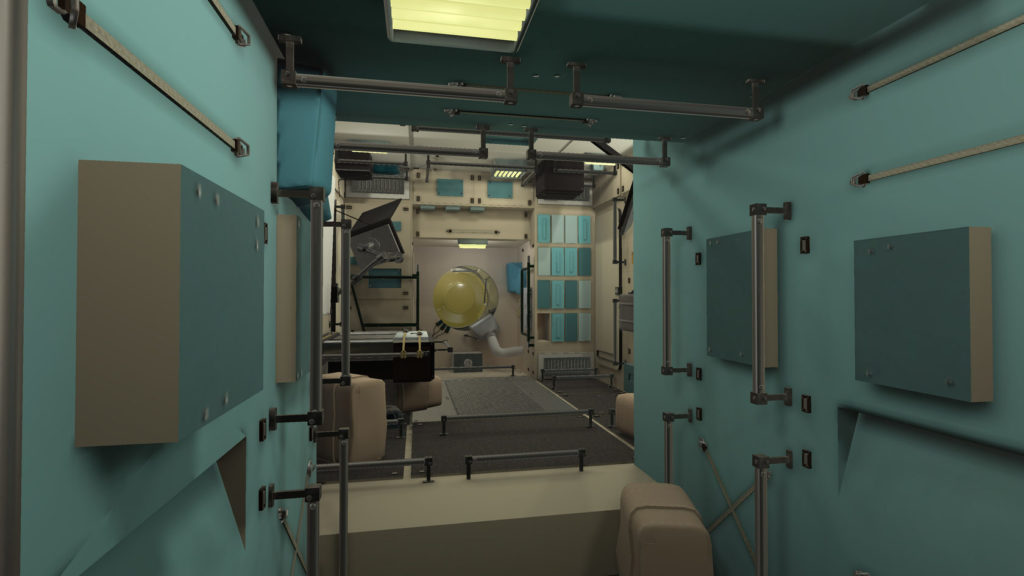
Hologram table for real estate companies
Any sales manager knows about the “wow-effect” but few have ever seen how it works. It is difficult to surprise customers now since they are educated, knowledgeable and familiar with the newest products.
However, there are innovative solutions that entered the market not long ago and haven’t become trite yet, such as hologram tables showcasing detailed 3D models of buildings or entire residential clusters. Interactive 3D models can help increase the potential of any building presentation and attract your audience during exhibition or client meetings.
This technology helps focus on detail: rotate, zoom in or out, ‘take off’ the roof and look at floor and room layouts, see how future residents will park their cars in the underground parking lot, and enjoy a bird’s-eye view of their entire district!
Why do clients enjoy presentations with hologram table?
Unlike traditional mock-ups, a hologram table speeds up a consultation by up to 10-30 minutes and gets 89.3% of positive reviews after the demonstration! We at NNTC can understand people who are lining up to try hologram table during exhibitions: we show presentations and videos a lot, but nothing compares to real experience when you walk around the hologram table and see a 3D building rotating with you.
While moving around the table, the patented system of high-speed cameras tracks the position of the user and renders the image to give a 3D view of the building from the right angle. This is a new customer experience, it provides a realistic view for people that have no time to go on-site, and, finally, it’s cheaper: you have one hologram table as a device with an unlimited number of models that can be installed. You can upload your own catalog of different objects: from a small house to a big five-star hotel.
The solution can display designs of any scale, from a single facility to the entire district, making it possible to zoom in and out various structures and cover much more project details during the presentation.
Are you interested in this solution? Contact us and we will share additional details!
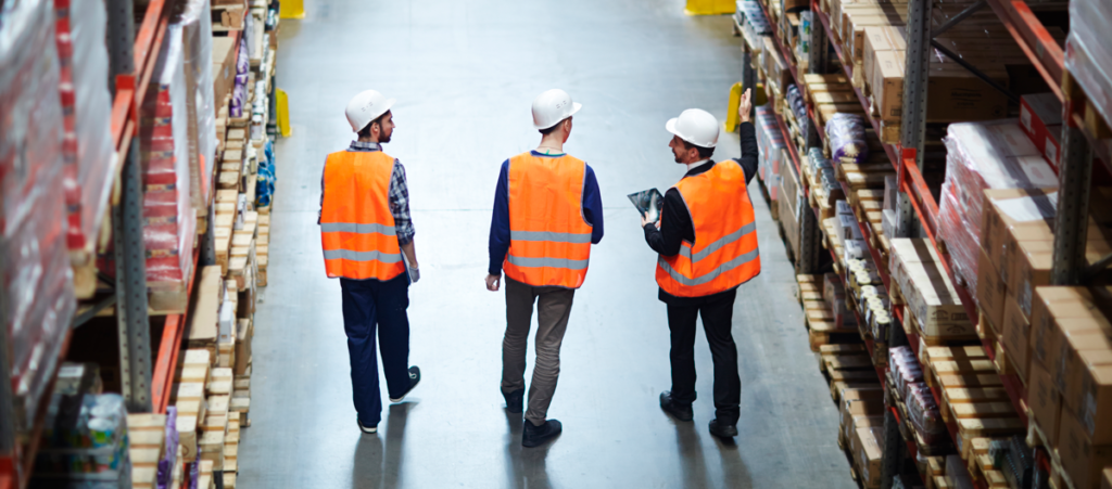
Tailoring innovation to customer’s specific task or business process has always been a second nature to our team. When cutting-edge technologies are integrated into any business process, many questions arise. Addressing them, we sometimes even dispel myths about some solutions and their functionality during a demo. Today, we will give answers to the most frequently asked questions about a drone-based & AI inventory solution for warehouse inventory by UVL Robotics.
Technology is like a set of versatile tools. Any problem can be solved with it, if you know how it all works at a fundamental level. In fact, innovation derives from a few pieces of technology successfully combined, thus creating a new product to get a particular job done effectively. The idea of a sci-fi future inhabited with smart robots and flying cars in a Blade Runner esthetics is a certain inspiration for us, like for all others. This is fantastic, but the primary goal of technology is to solve relevant problems using twenty-first-century tools.
Drone-as-a-service is a user-friendly solution to streamline warehouse inventory. It helps warehouses promptly handle inventories without extra time or money investment – read our previous post to learn more. Today, we will dive deep into solution functionality, what it can and can’t do.
Myths about drones and warehouses
Myth #1. Tricky when open
“Is it possible to count the exact number of boxes/products in an open pallet with this solution?”
That depends on the type of your pallet: a full or a mixed one. A full pallet is a completely sealed package with a certain amount of products inside and a barcode and other product information stuck outside.
Our drone-based solution is better at counting full pallets, as it scans the code from the sticker and sends the information to the server. Now, we need to know the number of boxes in one sealed pallet to easily calculate the total on the rack and at the warehouse.
It is not uncommon that somebody opens these pallets to pick up and deliver a few products to customers, which turns full pallets into mixed ones. Technically, our solution can scan the barcodes on such pallets and take a picture of a mixed pallet on the shelf, but it will be difficult to determine the exact number of whatever is inside. Products might be taken from the middle of the pallet (the rest forms something like a “well”) or from the side, which – should the pallet be turned – will face a wall and remain undetected at the time of inventory.
Here is what we can offer: a drone will both scan pallets and take pictures to report on each pallet in a warehouse. Each picture will be linked to the scanned barcode in the report. In addition, pallets can be labelled as mixed or full, so if there are a few mixed ones, the products inside can be counted manually or using a picture taken earlier.
Myth #2. Wrong stickers
“What if our employee puts a sticker on a pallet with the wrong barcode? Would you be able to fix it during warehouse demo?”
A drone is sadly unable to make it right. Perhaps a day might come when we can fully rely on machine intelligence and the drone’s commitment to a company, but not today. Currently, a drone only scans barcodes and records the pallet’s condition and location without carefully reflecting on what it is doing.
Myth #3. Any drone can take warehouse inventory
“Why do you use custom drones when there are plenty of common ones that you can easily make fly?”
It’s not that simple. In case of warehouse inventory, a standard drone, which can be piloted by almost anyone, is unlikely to take stock indoors, because such a drone is using GPS. It is challenging for signals from a satellite to pass through metal structures and thick walls of a warehouse, so a standard drone will be less than useless.
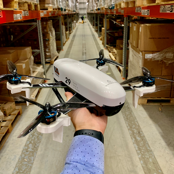
We use a custom drone with a built-in navigation system to dodge between racks without help from the GPS. Our experienced pilot can skillfully navigate the drone, which is yet another booster that helps complete the job fast.
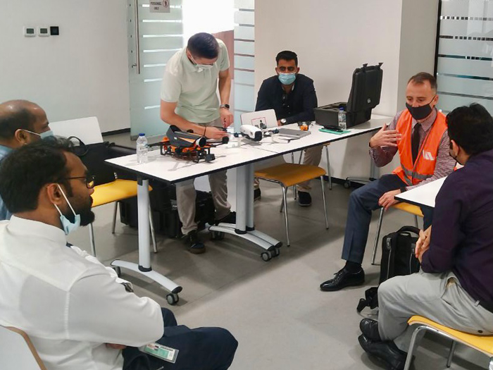
Why warehouse demo matters
A demo at a warehouse is an efficient way to bury myths and see solution benefits in a real-life situation. After all, like I said, a product is created to solve a specific problem, and a demo will help you understand whether this solution makes sense to your business.
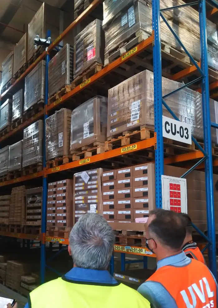
Our team has given demos for eight major warehouses in the UAE so far, including Abu Dhabi Ports. The demo includes the following:
A brief presentation to describe essential points of the solution and its main advantages (fast stocktaking, cost-efficiency, no heavy equipment involved, no warehouse downtime, etc. – my previous post covers everything in detail).
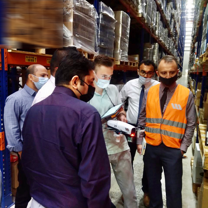
Moving on, a pilot has an assembled drone ready to demonstrate how the solution works. The drone flies between the racks and scans the pallets. A tablet allows you to watch and control scanning, as the scanned areas are highlighted on a warehouse model.
When information is collected, we export the report in an Excel file for you to review and study it carefully.
Finally, there is a Q&A session and a small amusement. Anyone can try on our pilot’s VR headset and enjoy the first-person view of the flying and scanning process.
We’ll be happy to give you a warehouse demo. Just answer a few organizational questions (to let us know the type of your warehouse) and choose a day convenient for a demo. No additional documentation is required. We are always ready to go.
How does your FMCG business feel in this game-changing 2021? Have you experienced tougher competition and more complex customer requests or, on the contrary, your business skyrocketed to the top of the world?
FMCG companies that implement digital transformation practices in their businesses have fewer losses during 2021. We studied multiple FMCG market researches along with our trusted partners to bring a special selection of innovative solutions to help you catch up on lost profits and strengthen your position in the market.
Drone-as-a-service for warehouse inventory
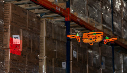
This solution is designed to save both time and money, if you face an unscheduled warehouse inventory. A skilled pilot arrives at your site with his own drone. Drone uses a 2D scanner to capture information from pallet barcodes at any height. It’s as simple as that: one drone can deal with 10,000 pallets in an hour, ensuring almost 100% recognition accuracy! No more time wasted, as you will no longer need to order additional equipment, reschedule warehouse shifts and make your employees work during weekends.
This solution is easy to implement but yet highly effective. It’s a useful tool for your employees to manage store performance. Ailet analyses shelf photos taken by a store clerk and detects different errors: incorrect price tags, misplaced products and other factors that reduce store profits. You can boost your team’s performance and get OSA +7%.
We also offer a powerful solution for supply chain planning and optimization. (By the way, it is based on the award-winning algorithm that topped the Google forecasting contest!) The software improves forecast accuracy by 25%, optimizes inventory turnover by 9%, and reduces operating costs. Being user-friendly, it can be easily integrated into any supply chain management process in the FMCG business.
Warehouse inventory can oftentimes lead to huge bills, so we approached third-party logistics (3PL) providers directly to learn more about their struggles.
The survey revealed that they generally experience similar problems:
Invest a lot of time in inventory (3-5 days)
Take pains to arrange unscheduled inventories (find a free time slot, select people for work, and reallocate resources)
Stop other work if inventory is urgent, get people in on a weekend, and pay overtime, with the warehouse being unable to generate profits during the inventory
Spend on equipment (a high reach forklift, for example): An inventory taking involves expensive equipment, which comes with a rent fee, delivery term, or other trouble.
Interestingly, only one in eight respondents considered using innovative technology to address the challenges above. Furthermore, we’ve had 50 meetings yet, and only one in six customers has considered a possibility of leveraging drones for inventories in the future. Although this idea is conceptually simple, it presents a serious challenge in practice. The core problem is to integrate an existing technology into an established task pipeline while having no experienced programmer, engineer, pilot or time/budget to get a proof of concept.
The good news is that we offer a user-friendly solution to streamline warehouse inventory: the first ever product on the market featuring customized drones that can promptly handle inventories without extra time or money investment.
A drone-based warehouse inventory
One operator is enough to control a drone that uses a 2D scanner to capture information from barcodes on pallets at any height (If you are interested in using this solution on a regular basis, AI-based automatic recognition can be integrated).
A ground control station (a set of ground-based hardware and software) matches scanned data against warehouse layout.
The results are forwarded to WMS/ERP.
The data processing is so fast that one drone can deal with 10,000 pallets in an hour in a standard warehouse, ensuring almost 100% recognition accuracy.
This solution is even more advantageous being provided as a service and saving training time and equipment costs. You only pay for the service; the rest is up to a drone piloting professional. The skilled pilot visits your site and gets an inventory done quickly and efficiently within the specified time using their own drone and VR headset. Warehouse inventory schedule can be drafted in advance when signing an agreement.
How do I know that my warehouse would benefit from such a solution?
The UVL Robotics solution can be an answer to any problems with warehouses that:
Do not use mixed pallets as their main sets (you don’t have to unpack the pallet and count everything item by item when taking inventory), but a full pallet (one pallet is an SKU with one barcode). After all, a drone can’t get into a pallet and count the number of boxes inside. But a drone is extremely good at flying around tall storage shelves and scanning barcodes on the pallets there.
Operate 5,000+ pallets; and working with warehouses with a capacity of 20,000-50,000 pallets is a special kind of fun. The more the better! A larger scale helps appreciate the impact of this technology in action.
3PL providers and FMCG companies are to benefit the most from the technology
From a 3PL provider perspective, warehouse inventory drones will make unscheduled inventories smoother and easier and save time that could be wasted on ordering special equipment, reallocating workers, and figuring out a least expensive option. Now, when a customer requests an urgent inventory, you can simply call in one pilot with a drone for a half-day visit to count the pallets on site.
This solution might be interesting for the FMCG sector, as numerous 2020-2021 surveys illustrate the importance of digital business transformation in response to the pandemic, which disrupted and exposed vulnerabilities in supply chains. Plant closures and changes to operating procedures, including socially distancing workers, have contributed to reduced production and labor output. Companies will need to re-examine their supply chains to develop a deeper understanding of risk in terms of sourcing and potential disruptions, and they might need to build in redundancies and alternative sourcing practices that promote resilience (PwC).
Outsourcing is another trending method. It helps your business focus on what you do best. Instead of having equipment, people or other resources as fixed expenses, you can outsource these to a third-party partner who has the expertise and can fully focus on the outsourced tasks to deliver best results. Assigning marketing and logistics tasks to an experienced and trusted partner helps business to focus on product innovation and quality improvement.
Adopting innovative solutions in business processes wisely might play a crucial role in surviving uncertain times. To learn more, download our survey results here:
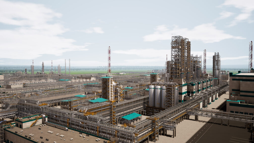
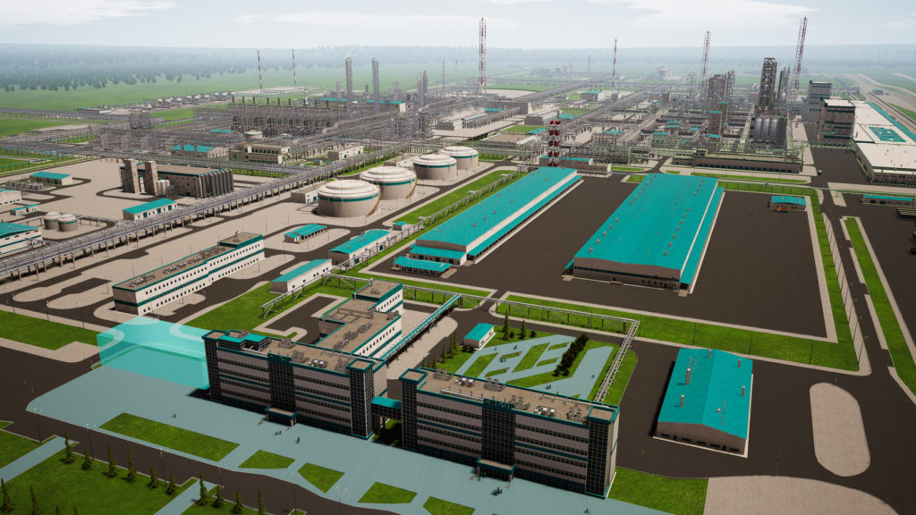
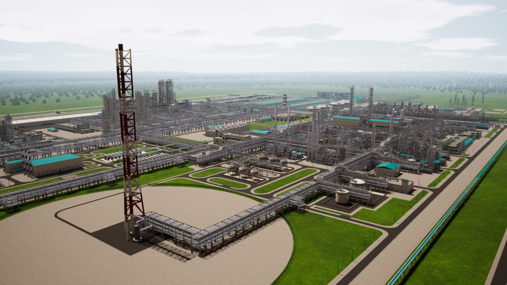
Oil and petrochemical refineries are rather complex sophisticated facilities demanding accurate management and proper maintenance. In this case, 3D models for production sites – an exact digital twin of a building – are created to help maintenance staff quickly reach a certain location, thus making their life easier.
Just one 3D model can replace tons of accompanying documents and dozens of conventional mock-ups.
Even the most accurate and well-crafted, mock-ups are of offline nature and provide general building details only. Instead, a 3D model is interactive and allows you to zoom in, turn around and remember any particular section.
Such a 3D model is an effective learning material, as clicking and travelling through it is more of an adventure than trying to handle a mock-up.
A 3D model is a HSE manual displaying hard-hats-on locations and places to avoid (even if you’re wearing a genius hard hat). Newcomers find interactive maps and routes more helpful in memorizing the object structure, compared to dull paper layouts.
On top of that, 3D models for production sites are less expensive to maintain (compared to a mock-up) and easy to move (a simple flash drive will suffice) and update with new data layers. Unlike mock-ups, a 3D model supports collaboration.
How to use 3D models for production sites?
In addition to replacing excessive documentation, a 3D model works as a simulator for employees to pass some internal assessment. Moreover, you can upload complete technical specifications of nodes over the model, so that employees could brush up the assignments and plan their activities before its shift.
Another trend is virtual tours for inspection authorities and stakeholders. One of our customers implemented a role-based model where users are granted different access rights depending on the assigned role. For example, some users can observe the entire model, including specifications and related details, while others see just equipment exterior and location, with some layers being simply hidden from their eyes. This results in different content for different roles without any chance of unauthorized access.
Industrial companies face similar challenges, which lead to lost profits: high LTIFR, unscheduled equipment downtime, and long-scheduled maintenance. Solutions based on immersive reality (digital models and VR trainings) can solve these problems.
Employee safety and health are top-priority tasks at any industrial enterprise. According to the International Labour Organization, approximately 2.3 million people worldwide die every year because of workplace accidents or occupational diseases, which number is equal to a large city population.
Accidents and work incapacity lead to idle time and equipment downtime, the company’s financial losses, and tarnished reputation. Yet too often, accidents and deaths are caused by employee error, proving that conventional occupational safety trainings are no longer sufficient.
These problems can be solved with training simulators, which visualize technological processes using VR and 3D technology. In addition, VR makes training as effective as that in real life.
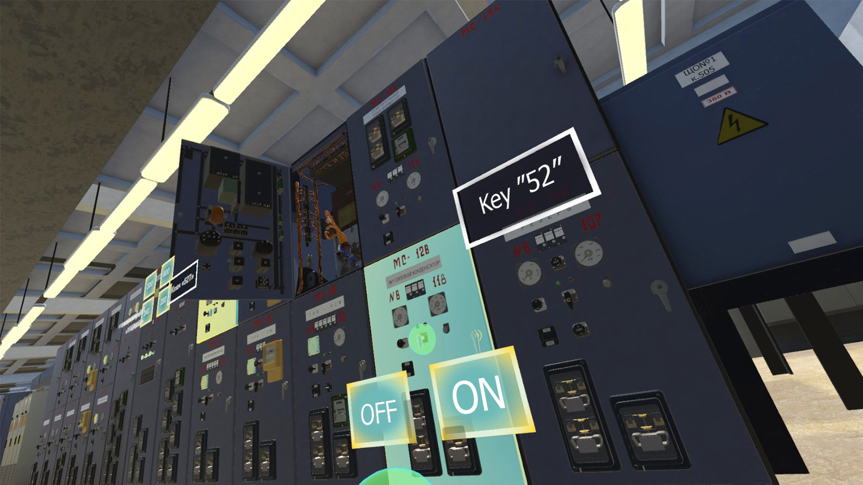
VR training is a must when it is hard or impossible to simulate an emergency in real life, such as a high-voltage plant operation or fire.
VR also help learn how a certain employee will respond and act in an extraordinary situation. For instance, you can run emergency scenarios in any sequence or even in parallel to make a trainee choose what to do to address the emergency.
Facing the facts about VR trainings
PwC recently studied the efficiency of training in VR. Here are the key takeaways:
During VR courses, employees can be trained up to four times faster!
VR learners are up to 275% more confident to act on what they learned after training—a 40% improvement over classroom and 35% improvement over e-learning.
VR learners are 3.75x more emotionally connected to the content than classroom learners.
VR learners were up to four times more focused during training than their e-learning peers, and 1.5 times more focused than their classroom peers.
VR learning can be more cost-effective at scale.
VR learning will likely be an enabler of a new age of enterprise training and education, delivering a cost-effective, immersive, and efficient soft-skill training experience. But how it’s done?
Should it be high voltage equipment failure or fire at the production facility, VR trainings help reveal employee reaction to any emergency or sudden obstacles, reproduce tricky situations when an incident doesn’t follow the usual scenario, and, more importantly, enables employees to get prepared to such incidents in advance. For example, the introduction of VR in Ford’s manufacturing process reduced injures by 70%.
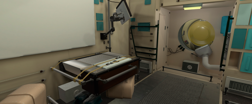
Both highly probable AND catastrophic risks for desalination plants include electric hazards and high-pressure fluids. Any hazardous situation or emergency can be easily reproduced in a computer simulation, with virtual reality technologies being capable of showing almost any content, including even “playback” of past accidents to prevent them in the future. For instance, we have recently helped one company to overcome some of the HSE challenges with the power of smart technology. Plant management was not sure of how well the team can handle emergencies and complex routine maintenance tasks. The cost of error or inaction can be quite high, as you certainly know.
We suggested using an innovative approach to tackle such a challenge: a VR simulation + operator training simulator (OTS). Workers can go through very realistic simulations as often as they need, which builds enough confidence and understanding to mitigate the risks and properly act in an emergency.
How VR trainings work
During such VR trainings, employees obtain necessary knowledge and skills and pass tests in a computer simulation, with the test results being available to the supervisor who thus can speed up onboarding and new knowledge perception through practice.
People get hands-on experience in the equipment whenever they need and simulate all kind of emergencies and maintenance tasks to gain confidence and speed. The consequences of any HSE breach can be reinforced in virtual reality through visual effects, like a full-screen explosion accompanied by bruising, thus impacting the psycho-emotional state of employees to make them more careful in their routine activities.
The benefit for the stakeholders is the transparency of skill assessment. There is a record of VR trainings for each employee – time spent on each particular action, the number of attempts, how often each task is practiced, etc.
High and medium voltage electrical equipment training is another hugely compelling use case demanded by our multiple customers:
We develop VR trainings because we know they save lives. If you are interested in how VR can be integrated into your organization, please contact us.
What’s usually attached to a drone? A video camera, of course. It is quite popular to mount it on the drone and lift as far above the ground as the connection reaches and catch a panoramic breathtakingly beautiful view on that camera. This is, however, a mere 9% of what you can do with this machine. Besides, there are a lot more interesting toys to mount on drones, and, in today’s post, I’ll tell you all about drone sensors.
Article by Pavel Tatarintsev, NNTC R&D Head LinkedIn | Mail
Sensors. There are a great many sensors one can attach to drones. You can give them a keen magic power to see things and solve business problems faster, and I’m excited to share the most impressive cases with you: oil spill detection and ground penetrating radar (GPR).
Drone sensors and oil spill detection
This drone sensor is a specific type of a thermal imager (looks like a tiny cube with an opaque black mirror lens) that can measure polarized light. Taking light as a form of an electromagnetic wave, we can distinguish electric and magnetic fields there. Before polarization, we have unpolarized light emitted, for example, by the sun or a lamp. Polarization means removing any electromagnetic waves from the beam, except for those being in a certain plane of polarization. Light reflected from oil and water has different polarization angles. Gotcha! Now you see it.
An on-board computer connects the drone and the sensor and processes data in real time. The camera receives two video streams: thermal radiation and the polarized (reflected) light in each pixel of the image. Both streams combined to allow for detecting hydrocarbons on the water surface (gas, diesel, oil, and kerosene).
Here is my recommendation regarding the best drone for such an industrial inspection. The choice, however, depends on the environment. For example, a kilometer-long and 0.5 kilometer-wide coastline inspection is a job for DJI M-200 and M-300 drones. If you need to monitor an area of at least 10 by 40 kilometers, then consider flying machines that look more like planes, as they can stay in the air longer (3-6 hours) and travel farther.
If a refinery is tasked with tracking oil spills in its waters, this sensor will be an essential asset, being able to detect the tiniest spills right away and avert a disaster. In addition, this sensor is more user-friendly than bulky marine radars and its polarization camera sees oil spills in calm waters, unlike the radar. Finally, you can schedule drone flights around the area to get updates on the state of the water around the production area.
Drones and GPR
Loosely speaking, GPR is a radar that can see underground. This drone sensor has a couple of commercial applications.
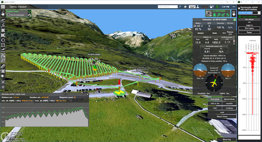
UgCS ground control software displaying GPR status
One of the most common and practical use cases is to locate pipes and other utility lines in urban areas. City development usually takes time and not always sticks to an initial plan, like in case of underground utility systems. Reasons differ. The original drawings could be lost and then recreated from memory or georeferencing wasn’t around until quite recently, while works were carried out some 30-40 years ago. Anyway, it’s a common thing when a drawing says that a water pipe is under the sidewalk, but, in fact, the pipe runs three meters away from there under the road.
Such discrepancies greatly complicate the planning of utility systems repair or installation. Just fancy that you need to lay new fiber-optic cables in an old city. You take the drawings, study them, and decide to lay a new pipe under the roadway. There you are: the traffic is blocked, roads are closed, concrete is broken up, and workers are digging. Two months and thousands of cubic meters later, they hit the pipe. To say it is a surprise might be an understatement.
GPR drone sensors can save you from such an oopsie. It detects the reflected signals from subsurface structures, but the material must have enough density to reflect these waves. I’ll give you an example. We are trying to survey a sandy area. There is a pipe two meters beneath the surface. The sand is quite transparent for radio waves. Having reached the pipe, the radio wave is reflected back to you, so the GPR can receive it and show you the location of the metal material under the sand. However, you won’t see anything under the pipe, because the radio wave has already been reflected back. Clay, metal, reinforced concrete and water (especially soil and salt water) reflect waves well. This radar is especially useful when you look for a perfect site to build a skyscraper.
There are high and low-frequency GPRs. The higher frequency, the more detailed image, but the less the vision depth is. In other words, at a higher frequency, you will see smaller objects more accurately. For example, a 100 MHz GPR will show you a metal pipe being one meter in diameter and laid three meters underground. But it will be blind to a pipe with a diameter of ten centimeters – such a small object requires a radar of higher frequency. However, depending on the ground, low-frequency GPRs can locate objects at the depth of 30, 40, and even 100 meters. SPH Engineering, for example, discovered a whole plane in a glacier in Greenland buried 130 meters under ice, which is made of distilled water and thus remains transparent for radio waves.
SPH Engineering helps locate aircraft buried under Greenland ice with GPR
Drone sensors – a tool for every job
You can select a perfect sensor for the job when you set the objectives. Say, you need to find a metal object under the layer of the salt sand that doesn’t allow waves through. Use a magnetometer. If so required, you can put an ultrasonic sensor to use. But that’s another story to tell sometime later.
To conclude, technologies have a wide range of applications to solve any task of any complexity. Think out of the box and you’ll find the way.
Drones perform multiple functions and can be used virtually in any industry. Goldman Sachs forecasts a $100 billion market opportunity for drones as powered by growing demand from the commercial and civil government sectors: $45 billion (infrastructure), $32 billion (agriculture), $13 billion (transport), and $10 billion (security). Drone use by builders is rather promising as drones can be introduced at any construction and development stage.
What can drones do at a construction site? Drones can optimize the construction process in various unexpected ways. Let’s talk about the following three functions:
1. Construction progress control 2. Assessment of emergencies 3. Building Information Modeling
Construction progress control helps to acquire information on construction site changes over specific period and compare current status with planned construction documentation. Drone flies around the construction site in an automated mode, while also taking photos and making orthophoto-, 3D- and landscape maps. The accumulated data goes to a private web portal accessible to responsible persons and construction stakeholders only, thus contributing to fast and streamlined communication between construction participants, as well as easier control over staff performance.
Drones also provide ad-hoc monitoring of the location of construction machinery, construction materials and temporary facilities. Small-sized drones can approach hard-to-reach engineering components.
Assessment of emergencies. In case of emergency, a drone flies on site to take photos and shoot videos, with all information being sent online to a situation center for prompt issue resolution. In addition, drones can perform live broadcasting.
Building Information Modeling. Drone photogrammetry makes it possible to not only match a certain construction stage with the plan but also then deliver an eye-catching site presentation in 3D. Once construction is over, a drone flies around the completed site and collects data to be then transformed into a precise 3D model of the facility. Such a model can be easily presented on a holographic table, a new presentation tool for real estate segment.
Drones are compatible with various advanced technologies (e.g. video analytics, BIM, drone show software and security solutions) and thus can be used almost in any sector.
Any industrial inspection solves three main tasks: data collection (photos of objects), analysis (identifying defects and abnormalities), and reporting. Today, Pavel Tatarintsev will talk about ATLAS – image analysis and automatic reporting system that covers the most labor-intensive industrial inspection tasks.
Article by Pavel Tatarintsev, NNTC R&D Head LinkedIn | Mail
Naturally, ATLAS is not the first solution on the market that analyzes photos and automates reporting, but its unique easily trainable AI module makes it a truly handy and unparalleled tool.
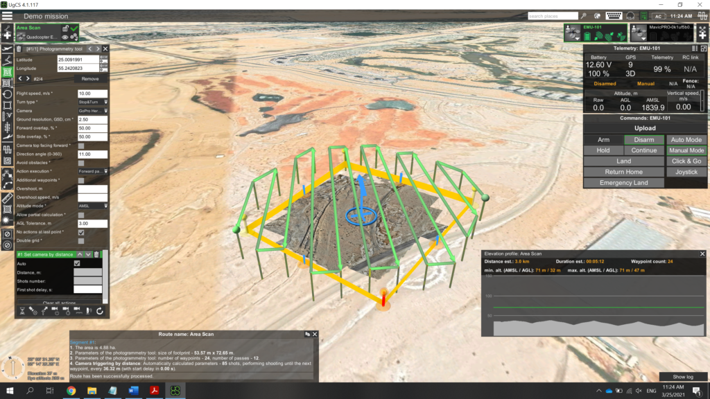
How I taught ATLAS to find bushes in the desert
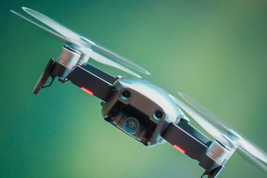
I will describe the module operation using my own user experience as an example. One weekend, I decided to go to the desert and, just for fun, teach my ATLAS to recognize bushes. It was an easy, interesting, and clear process. I used a standard laptop with installed UgCS and ATLAS software, as well as a 400g DJI Mavic Air drone with a built-in wide-angle camera. This is a small, quite popular and affordable drone.
First, an engineer needs to draw a route for a drone in UgCS (below is the screenshot of my drone’s route). I set the frequency of taking photos and the following parameters. It took my drone 15 minutes to fly around three hectares.
As a result, I got approximately 100 photos for analysis.
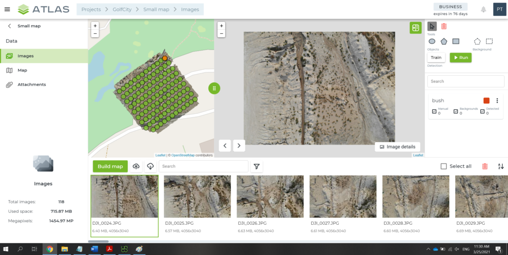
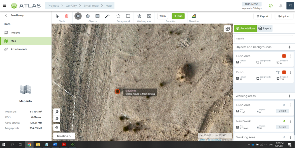
I uploaded the photos to ATLAS, which, in 5 minutes, created an area map with the relief. As I wanted ATLAS to learn how to find bushes, I then used a marker to outline the bushes on some 20-30 photos and launched a search by photos.
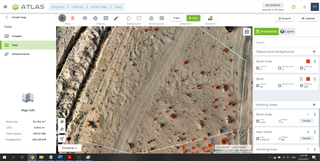
In 20 minutes (including AI training and photo search), I got my result. The program managed to count not only the number of bushes, but also (if needed) the total area covered by them. Indeed, you can set any parameters and reporting targets for this flexible and intelligent solution.
It is efficient, isn’t it? I believe very much so. Now imagine that the solution can find not only bushes, but also cracks on roads, rust on metal structures (for example, rusty spots on ships), oil spills, and any other things or flaws that the built-in AI can learn.
Is it easy to teach ATLAS AI for drone industrial inspection? Depends on what you want it to learn. When it comes to rusty spots on the pipe surface, all it takes is just a few photos with outlined spot examples. But if you need AI to find a green car in the green leaves, it’s more challenging and the system will need more examples for training.
ATLAS and industrial inspection tasks
Let me tell you the story of one of our customers (without mentioning its name). Our customer bought a ‘fixed-wing’ drone (a plane-like model that can fly continuously over long distances, collecting necessary data) and had a camera installed on it to shoot the sea surface. The drone flew and brought back 12,000 photos to be analyzed for oil spills. Just imagine how long it would take to manually analyze and document all these photos. Plus, oil film is often very difficult for the human eye to see on the waves. Nevertheless, the customer successfully addressed the challenge opting for ATLAS that was taught by an engineer to promptly find oil spills on photos.
This solution is also used to fly around and inspect the condition of oil pipes and production facilities, survey vegetation, as well as scan object surfaces, soil, and asphalt. The solution can be easily applied virtually in any sector and for any task. You can even set it the task to not only looking for defects but also rank them by hazard.
This is how artificial intelligence facilitates inspections and ensures control over the safety of both facilities and the environment. All you need to do is ‘explain’ ATLAS what task you want it to solve.
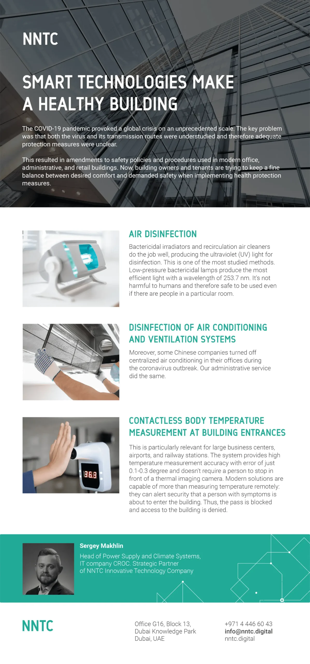
The COVID-19 pandemic provoked a global crisis on an unprecedented scale. The key problem was that both the virus and its transmission routes were understudied and therefore adequate protection measures were unclear. This resulted in amendments to safety policies and procedures used in modern office, administrative, and retail buildings.
Now, building owners and tenants are trying to find new solutions for workplace safety and health. How to keep a fine balance between the desired comfort and demanded safety?